Flood-proofing cities by using digital twins in urban design
Dr Langenheim explores the use of data and new technologies for streetscape and green infrastructure design decision making.

First published by the University of Melbourne
Dr Nano Langenheim is a Senior Lecturer in Landscape Architecture and Urban Design in the Faculty of Architecture, Building and Planning. She is an experienced landscape architect, arborist and urban designer, and the Assistant Dean Technology for the Faculty.
Dr Langenheim explores the use of data and new technologies for streetscape and green infrastructure design decision making. She collaborated with University of Melbourne engineers to develop a digital tool that helped test flood management strategies for Australia’s largest urban renewal project.
In urban design, we will often get a set of principles: we want to instigate water-sensitive urban design. We want to have sustainable use of land, we want to recognise Indigenous peoples, and we might also want to have shaded walkways.
But all these things have to fit in very tight spaces, they are in competition with one another for real estate on urban streets. You can be fighting over 300 millimetres for enough space for tree roots or enough space to put in a water detention system, or any number of other things. The more data you can feed into that decision making, hopefully the better that decision you make is.
In the early 2000s, tree data was still very paper-based. It was exceedingly difficult for anyone to bring that into their decisions about anything else. In urban environments, everything you change impacts something else.
Digital twins allow your data to talk to other data. If you have a data set in a suitable format for visualising against something else, this should help you make better decisions. Dr Nano Langenheim
Digital twins are romantic idea, particularly in urban design. Digital twins used to be about, for example, an offshore oil rig. You needed a tool that you could use to understand what was happening in real time on that oil rig. if there was a fire, you could remotely turn sprinklers on. It was a very management-driven idea initially. We were interested in taking that same management technology and using it for infrastructure planning.
Fishermans Bend is the biggest urban renewal project in Australia. I think it was the biggest urban renewal project in the southern hemisphere for a while. It's about four times the size of the Melbourne CBD. And it has a very political history. It was an important ecological site for First Nations peoples before being utilised quite aggressively by industry. It’s already very polluted. But in many ways, it's a really good choice to redevelop. Rather than building new suburbs, you put your urban design into an already heavily modified site.
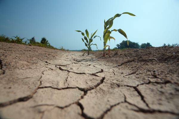
But it’s stricken by flood. There are five neighbourhoods at Fishermans Bend, all of which are potentially subject to sea level rise problems among other forms of flooding. If a street can't fit a water detention system, we need to know early on, so we can plan for flood mitigation measures within the buildings.
How do we analyse how much water the Fishermans Bend urban renewal project streetscape can hold? It sounds like something that would be quite a simple question to answer, but it's complex because you're working with very complex geometry.
With digital twins, we can experiment with different scenarios and solutions without impacting any existing structure or plans. We can test options in real time.Dr Nano Langenheim
The digital twin is also useful to make things explainable to government and the community. We knew full well that there would be a lot of peculiar decisions that would need to be made in Fishermans Bend that would deliver a pretty atypical-looking development. The resulting form would need to be described to the community in a way that would help them understand why and how it came to be that way.
Working with the Faculty of Engineering and IT on this project was great. We just happened to have the people with the right background in the room. I had things to offer their digital twin, and their digital twin had things to offer to me. Throughout the project, we were all rapidly teaching each other. Our disciplines have slightly different research methods, we have different language to describe sometimes similar phenomena, and with complex projects, we have different objectives. It took us some time to break down the task and keep our aims clear. In this case we had to both ‘solve a problem’ using new data in new ways, and then we needed to communicate the outcomes of the data-driven solution to that problem to the community, engineering, design and government stakeholders.
I try to use the digital twin platform for everything now. It’s just a great tool that is revolutionising our urban design methods. We have a many projects where we're looking at multicriteria decision-making with the digital twin in complex existing environments.